Datei:Moorea vue par Sentinel 2 (cropped).jpg
Originaldatei (1.038 × 885 Pixel, Dateigröße: 760 KB, MIME-Typ: image/jpeg)
Beschreibung
| Beschreibung |
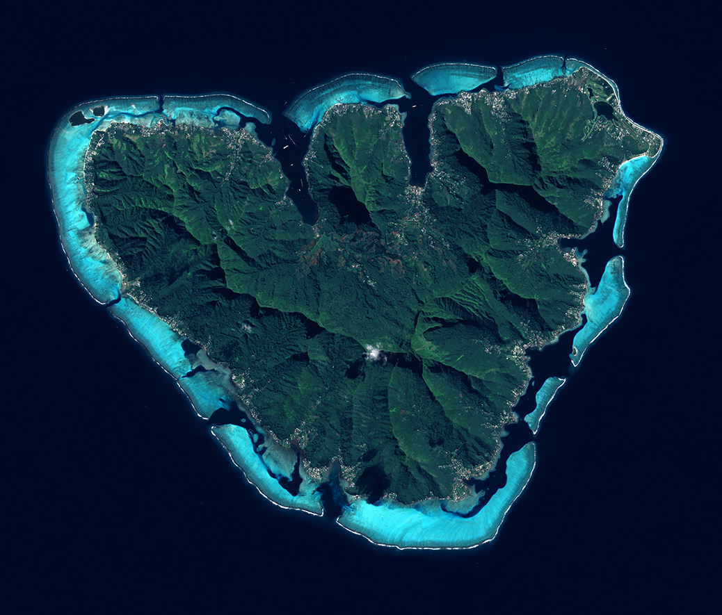
English: L'ile de Moorea vue par le satellite Sentinel 2, le 21 juin 2021.
Moorea est une ile du Pacifique Sud situee dans l'archipel de la Societe en Polynesie francaise. Elle est connue pour ses sommets volcaniques abrupts et ses plages de sable. La mission Sentinel-2 fait partie du programme d’observation et de surveillance de la Terre, Copernicus, conduit par l'Union Europeenne. Grace aux 2 satellites Sentinel-2A (2015) et Sentinel-2B (2017), tous les 5 jours, la mission Sentinel-2 fournit des cliches de notre planete. Objectifs : suivre a haute resolution l'evolution de la vegetation, de l'occupation des sols et l'impact du rechauffement climatique avec une haute frequence d’observations. |
| Datum | |
| Quelle | https://phototheque.cnes.fr/cnes/media/69129 |
| Urheber | European Space Agency / CNES |
| Andere Versionen |

.jpg)
| Kameraposition | | Dieses und weitere Bilder auf OpenStreetMap |
|---|
.jpg¶ms=-17.533292_N_-149.905357_E_globe:Earth_type:camera__&language=de)
Lizenz

|
This image contains data from a satellite in the Copernicus Programme, such as Sentinel-1, Sentinel-2 or Sentinel-3. Attribution is required when using this image.
Namensnennung: Contains modified Copernicus Sentinel data 2021
The use of Copernicus Sentinel Data is regulated under EU law (Commission Delegated Regulation (EU) No 1159/2013 and Regulation (EU) No 377/2014). Relevant excerpts:
Free access shall be given to GMES dedicated data [...] made available through GMES dissemination platforms [...].
Access to GMES dedicated data [...] shall be given for the purpose of the following use in so far as it is lawful:
GMES dedicated data [...] may be used worldwide without limitations in time.
GMES dedicated data and GMES service information are provided to users without any express or implied warranty, including as regards quality and suitability for any purpose. |

|
Dieses Bild ist nach den Kriterien für wertvolle Bilder beurteilt worden und gilt als das hochwertigste auf Commons im Bereich: Moorea island, French Polynesia - satellite view. Die Nominierung des Bildes ist nachzulesen unter Commons:Kandidaturen hochwertiger Bilder/Moorea vue par Sentinel 2 (cropped).jpg. |
.jpg)
Dateiversionen
Klicke auf einen Zeitpunkt, um diese Version zu laden.
| Version vom | Vorschaubild | Maße | Benutzer | Kommentar | |
|---|---|---|---|---|---|
| aktuell | 16:08, 26. Mai 2022 | | 1.038 × 885 (760 KB) | Don-vip | File:Moorea et Tahiti vues par Sentinel 2.jpg cropped 79 % horizontally, 77 % vertically using CropTool with lossless mode. |
Dateiverwendung
Die folgende Seite verwendet diese Datei:
Globale Dateiverwendung
Die nachfolgenden anderen Wikis verwenden diese Datei:
- Verwendung auf ar.wikipedia.org
- Verwendung auf arz.wikipedia.org
- Verwendung auf ca.wikipedia.org
- Verwendung auf cy.wikipedia.org
- Verwendung auf en.wikipedia.org
- Verwendung auf en.wikivoyage.org
- Verwendung auf fr.wikipedia.org
- Verwendung auf fr.wikivoyage.org
- Verwendung auf he.wikivoyage.org
- Verwendung auf ru.wikipedia.org
- Verwendung auf simple.wikipedia.org
- Verwendung auf ur.wikipedia.org
- Verwendung auf www.wikidata.org
.jpg)